


Indianola Precinct, Red Willow County, Nebraska
About
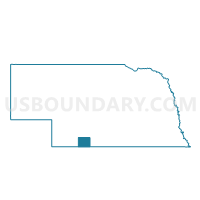
Outline

Summary
| Unique Area Identifier | 613756 |
| Name | Indianola Precinct |
| County | Red Willow County |
| State | Nebraska |
| Area (square miles) | 71.39 |
| Land Area (square miles) | 71.04 |
| Water Area (square miles) | 0.34 |
| % of Land Area | 99.52 |
| % of Water Area | 0.48 |
| Latitude of the Internal Point | 40.28083910 |
| Longtitude of the Internal Point | -100.37382290 |
Maps


Graphs
Select a template below for downloading or customizing gragh for Indianola Precinct, Red Willow County, Nebraska


Neighbors
Neighoring Voting District (by Name) Neighboring Voting District on the Map
- Bartley Precinct, Red Willow County, NE
- Beaver Precinct, Red Willow County, NE
- Stockville Precinct, Frontier County, NE
- Willow Precinct, Red Willow County, NE
Top 10 Neighboring County Subdivision (by Population) Neighboring County Subdivision on the Map
- Indianola precinct, Red Willow County, NE (673)
- Red Willow precinct, Red Willow County, NE (259)
- East Valley precinct, Red Willow County, NE (235)
- North Valley precinct, Red Willow County, NE (81)
- Fritsch precinct, Red Willow County, NE (72)
- Garfield precinct, Frontier County, NE (66)
- Bondville precinct, Red Willow County, NE (58)
- Tyrone precinct, Red Willow County, NE (44)
- Alliance precinct, Red Willow County, NE (44)
- Missouri Ridge precinct, Red Willow County, NE (26)